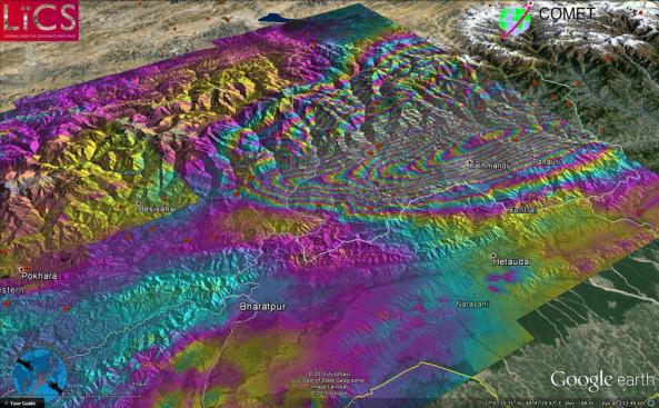
A new clearer sentinel 1 satellite image has been produced by COMET researchers as part of the Look Inside the Continents from Space (LiCS) project led by CGS scientist Professor Tim Wright.
For Tim Wright’s preliminary interpretation of the results see our previous post.

Sentinel 1 image of the Nepal earthquake deformation. 1 colour fringe = 10cm of ground deformation.
Source: John Elliot – LiCS/COMET+

Pingback: First Sentinel 1 satellite results for Nepal earthquake | CLIMATE AND GEOHAZARDS
Pingback: First Sentinel 1 satellite results for Nepal earthquake | CLIMATE AND GEOHAZARDS
Pingback: Nepal earthquake lowers Everest by up to 2.5 cm | CLIMATE AND GEOHAZARDS