Raising awareness of current research and developments in the fields of climate science and natural hazards and translating these into real benefits for people and organisations.
On May 12th 2015, while volunteering with The Salvation Army in Nepal, Michael and his team were hiking in the Sindhupalchowk area trying to reach some isolated villages in the region to see what kind of support could be offered. This are was very close to the epicenter of the 7.3 earthquake that struck that day. Earthquakes in Nepal are notorious for triggering landslides, which kill many Nepalese each year. This footage shows the dangers and magnitude of landslides which can be triggered by earthquakes in this area.
Further analysis of the newly processed sentinel-1 satellite radar data shows that the area around the Kathmandu region was uplifted in the earthquake, while the area to the north of Kathmandu sunk (subsided).
The red region in the image below shows uplift while the faint blues to the north indicate subsidence. Mount Everest is located to the northeast of Kathamndu.
Processed Sentinel-1 results of the Nepal earthquake deformation. red = mostly uplift, blue = mostly subsidence. Source: Pablo Gonzalez – LiCS/COMET+
The image was produced by COMET researchers at the University of Leeds as part of the Look Inside the Continents from Space (LiCS) project led by CGS scientist Professor Tim Wright.
New computer modelling results estimate that the amount of lowering experienced in the Everest region could be up to 2.5cm. These numbers are very preliminary and will be verified over the coming days with further research.
A new clearer sentinel 1 satellite image has been produced by COMET researchers as part of the Look Inside the Continents from Space (LiCS) project led by CGS scientist Professor Tim Wright.
For Tim Wright’s preliminary interpretation of the results see our previous post.
Sentinel 1 image of the Nepal earthquake deformation. 1 colour fringe = 10cm of ground deformation. Source: John Elliot – LiCS/COMET+
1. The earthquake ruptured East from the epicentre, confirming the observations from seismology.
2. Peak displacement is very close to Kathmandu; the fault under the city slipped significantly.
3. An area at least 120×50 km uplifted, with a maximum slip greater than 1m
4. The fault did not rupture the surface.
5. Area north of Kathmandu subsides. Consistent with elastic rebound from shallow thrust.
[CORRECTION]: The area around Kathmandu is uplifted in the earthquake
6. Overall, area at least 120 x100 km moved. Sentinel-1 data invaluable at this scale.
A powerful magnitude 7.8 earthquake struck Nepal on April 25, causing extensive damage in the capital Kathmandu and neighbouring cities with a death toll at the time of writing of more than 3,700.
The earthquake triggered an avalanche on Mount Everest, which swept away several base camps and killed 18 people.
The Nepalese government has declared a state of emergency and requested international assistance.
At approximately 11:56 local time on April 25, a magnitude 7.8 earthquake struck central Nepal. The earthquake occurred at a shallow depth between 10 to 15km according to the USGS. The epicentre was located 77km northwest of Nepal’s capital city Kathmandu. Several dozen aftershocks followed the main event, the largest of which was a magnitude 6.7 northeast of Kathmandu on April 26th.
The shallow earthquake depth coupled with the large magnitude resulted in high intensity ground shaking over a very large area (approximately ~75,000 square km around the epicentre). The affected countries include Nepal, India, China and Bangladesh.
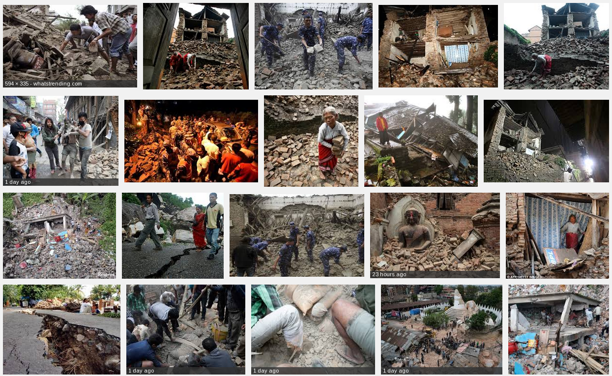
Some images of the destruction caused by the Nepal earthquake. Source: Google
At the time of writing, the international media report a death toll of at least 3,700. Mostly caused due to collapsed structures. Search and rescue is on-going. The Government of Nepal (GoN) has declared a state of emergency for earthquake affected areas and requested international assistance. GoN-identified priority needs include search-and-rescue capacity, medical assistance, rubble-removal equipment, and logistical support for transport to difficult-to-access areas, according to the UN.
Damage:
The earthquake has caused extensive region wide damage to several cities in Nepal including the districts Lamjung, Gorkha and around the Kathmandu region. Initial observations in Kathmandu by locals and reported on social media, claim that about 20 percent of all buildings in Kathmandu were damaged or destroyed. The earthquake also damaged roads and other public infrastructure.
The high intensity earthquake shaking triggered an avalanche on the slopes of Mount Everest. The avalanche swept away and completely destroyed part of the Everest base camp. The popular route through the Khumbu ice fall was blocked trapping climbers further up at camps 1 and 2. Initially reports arrived of dozens of missing and trapped climbers. 18 people were killed and evacuations are under way to bring all other climbers back down from the mountain.