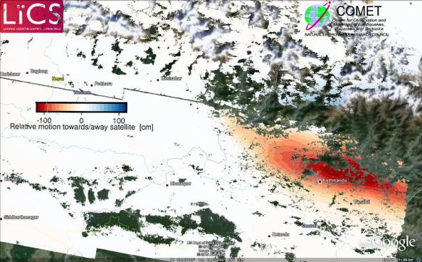
Further analysis of the newly processed sentinel-1 satellite radar data shows that the area around the Kathmandu region was uplifted in the earthquake, while the area to the north of Kathmandu sunk (subsided).
The red region in the image below shows uplift while the faint blues to the north indicate subsidence. Mount Everest is located to the northeast of Kathamndu.

Processed Sentinel-1 results of the Nepal earthquake deformation. red = mostly uplift, blue = mostly subsidence.
Source: Pablo Gonzalez – LiCS/COMET+
The image was produced by COMET researchers at the University of Leeds as part of the Look Inside the Continents from Space (LiCS) project led by CGS scientist Professor Tim Wright.
New computer modelling results estimate that the amount of lowering experienced in the Everest region could be up to 2.5cm. These numbers are very preliminary and will be verified over the coming days with further research.
