Raising awareness of current research and developments in the fields of climate science and natural hazards and translating these into real benefits for people and organisations.
Since 1900, 35 earthquakes worldwide have each killed at least 10,000 people. Of these, 26 were in the Alpine-Himalayan seismic belt – a broad “crumple zone” where the African, Arabian and Indian tectonic plates collide with Europe and Asia. Most of these deadly earthquakes were caused by the rupture of faults that had not previously been identified.
CGS scientist Tim Wright is Professor of Satellite Geodesy at the University of Leeds and Director of the Natural Environment Research Council’s Centre for the Observation and Modelling of Earthquakes, Volcanoes and Tectonics (COMET). His work has been at the forefront of developing the use of satellite radar for measuring tectonic and volcanic deformation.
Tim was recently invited to present a guest lecture at the Geological Society on his work trying to understand the nature of seismic hazard within the Alpine-Himalayan region.
1. The earthquake ruptured East from the epicentre, confirming the observations from seismology.
2. Peak displacement is very close to Kathmandu; the fault under the city slipped significantly.
3. An area at least 120×50 km uplifted, with a maximum slip greater than 1m
4. The fault did not rupture the surface.
5. Area north of Kathmandu subsides. Consistent with elastic rebound from shallow thrust.
[CORRECTION]: The area around Kathmandu is uplifted in the earthquake
6. Overall, area at least 120 x100 km moved. Sentinel-1 data invaluable at this scale.
A powerful magnitude 7.8 earthquake struck Nepal on April 25, causing extensive damage in the capital Kathmandu and neighbouring cities with a death toll at the time of writing of more than 3,700.
The earthquake triggered an avalanche on Mount Everest, which swept away several base camps and killed 18 people.
The Nepalese government has declared a state of emergency and requested international assistance.
At approximately 11:56 local time on April 25, a magnitude 7.8 earthquake struck central Nepal. The earthquake occurred at a shallow depth between 10 to 15km according to the USGS. The epicentre was located 77km northwest of Nepal’s capital city Kathmandu. Several dozen aftershocks followed the main event, the largest of which was a magnitude 6.7 northeast of Kathmandu on April 26th.
The shallow earthquake depth coupled with the large magnitude resulted in high intensity ground shaking over a very large area (approximately ~75,000 square km around the epicentre). The affected countries include Nepal, India, China and Bangladesh.
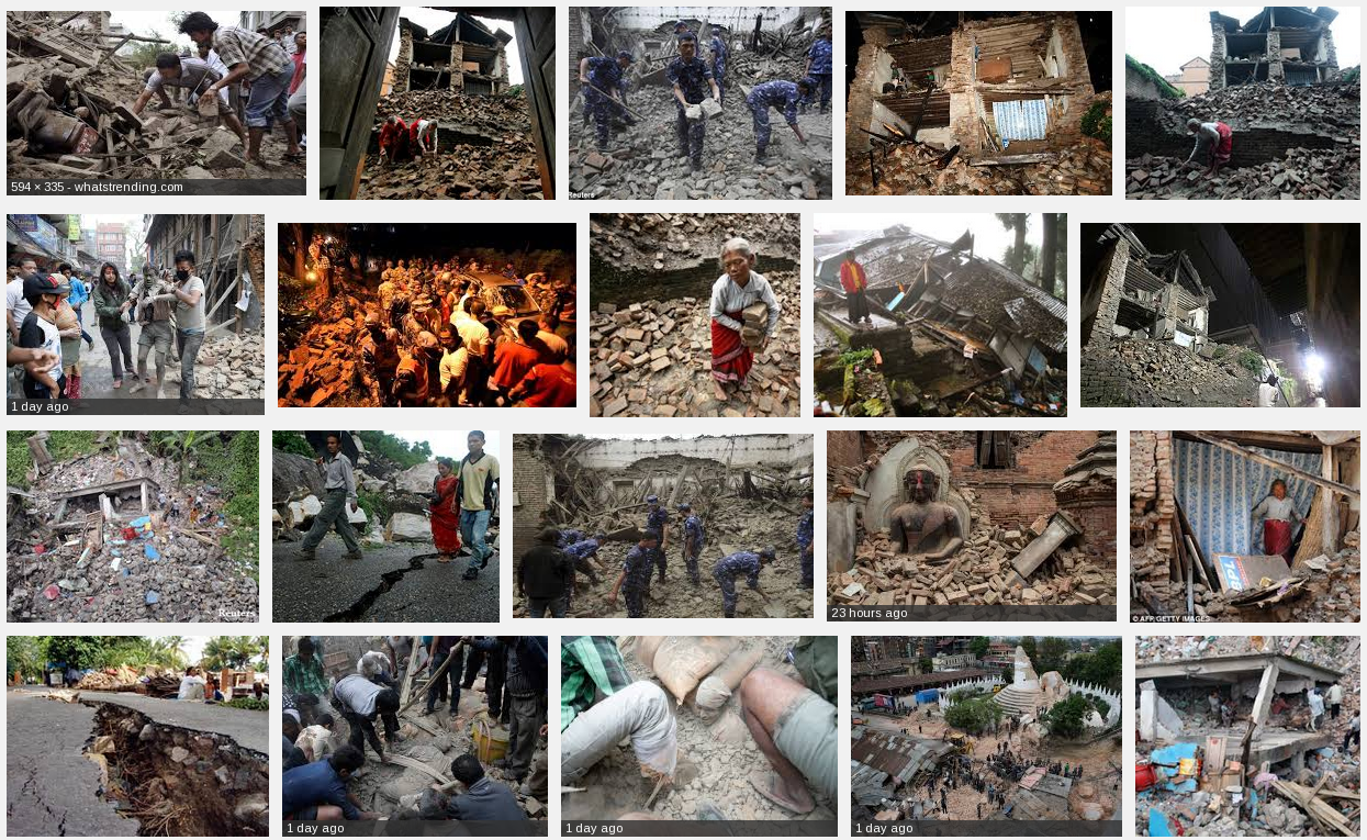
Some images of the destruction caused by the Nepal earthquake. Source: Google
At the time of writing, the international media report a death toll of at least 3,700. Mostly caused due to collapsed structures. Search and rescue is on-going. The Government of Nepal (GoN) has declared a state of emergency for earthquake affected areas and requested international assistance. GoN-identified priority needs include search-and-rescue capacity, medical assistance, rubble-removal equipment, and logistical support for transport to difficult-to-access areas, according to the UN.
Damage:
The earthquake has caused extensive region wide damage to several cities in Nepal including the districts Lamjung, Gorkha and around the Kathmandu region. Initial observations in Kathmandu by locals and reported on social media, claim that about 20 percent of all buildings in Kathmandu were damaged or destroyed. The earthquake also damaged roads and other public infrastructure.
The high intensity earthquake shaking triggered an avalanche on the slopes of Mount Everest. The avalanche swept away and completely destroyed part of the Everest base camp. The popular route through the Khumbu ice fall was blocked trapping climbers further up at camps 1 and 2. Initially reports arrived of dozens of missing and trapped climbers. 18 people were killed and evacuations are under way to bring all other climbers back down from the mountain.
It’s a big month as the Geology for Global Development team embark on a major natural hazards education and sustainable development project in the Himalayas.
The project (part of a broader sustainable development project in the Himalayas) will be aiming to:
Share our knowledge and expertise,
Learn from others about aspects of best practice in both understanding science and understanding culture and social development,
Identify practical skills development opportunities for students in the UK.
CGS academics are also involved with this project. Professor Tim Wright will be giving a keynote lecture at the conference in India later next week and Ekbal Hussain has contributed to a booklet that will be used to teach school children about natural hazards in the Himalaya region (above image).